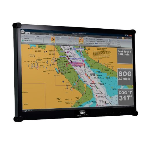
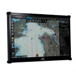
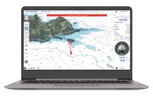
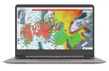
TimeZero Navigator is a sophisticated PC charting software package with advanced navigation and AIS capabilities and a wide choice of charting formats. Have the world at your fingertips thanks to the MapMedia charts catalog compatible with TZ Navigator. The introduction of TZ MAPS, a revolutionary nautical chart format, gives you access to all types of data available for your area: Raster, Vector, detailed land information, high-resolution satellite photos, and high-resolution Bathymetry. In addition, TIMEZERO technology integrate an unparalleled chart engine where marine charts, 3D data, and satellite photos are intelligently combined through PhotoFusion. Charts can be viewed at www.maxsea.com
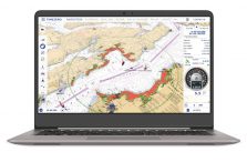
Timezero Navigator is ideal for use on the Aqua Compact Pro and Pro Plus systems. It’s fully compatible with Windows 10 & 11 and also with our iKonvert USB-NMEA 2000 gateway, USB-NMEA 0183 adaptor and NavLink wireless gateways. It also supports an autopilot output via our USB-NMEA 0183 adaptor. Create marks, waypoints, routes, boundaries, lines, annotations & even add a photo as user objects. Waypoints and routes can also be sync’d across the cloud and used in the TZ iBoat iOS app for an integrated tablet and PC solution. Full AIS display capability with CPA/TCPA alarms and target list and integration with internet AIS like Marine Traffic if an internet connection is available. Download weather for an animated display layered onto chart with wind, temp, pressure and wave information.
Options include Radar Module (compatible with new Furuno DRS4DNXT radars), Sounder Module and Weather Routing Module. The Weather Routing Module is ideal for long distance sailors and provides routing according to wind, waves and currents with isochrones overlay. Routing calculation automatically avoiding the coastline and shallow water (with possibility to set the depth limit), dual route calculation sail/motor (depending on the wind and theorical speed limit) and expected wind conditions display along the track.
Delivered as a digital download or pre-installed on our Aqua PCs, it comes with a licence for up to 2 PCs. Charts are not supplied with the software.